Historical version 9 of Ayat, 49c South End (view current version)
- 49c South End, CR0 1BF
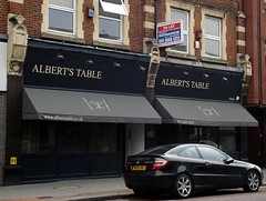
- albertstable.co.uk
Modern British restaurant on South End.
See also:
Existence last checked in February 2015.
South End
...


 ...
...
...
OS X co-ord:
532441
OS Y co-ord:
164720
(Latitude:
51.365582
Longitude:
-0.097310)